 Snow is accumulating at Paradise. I measured 46" total, with 15" of fresh snow this morning. It looks and feels like winter and if the park were open, skiers, boarders and snowshoers would be enjoying the early snowfall. But the floods really did a number on the roads and as the days pass, it becomes more clear how complicated the damage is, especially with the prompt arrival of winter.
Since it's going to be difficult to write about the climbing routes and upper mountain while the park is closed, I will devote more energy to the events surrounding the park being reopened. There will be updates, damage assessments, projected repairs and ongoing weather observations. I'll also pull together photos, when possible, like these NPS pictures of the Ohanapecosh area.

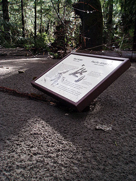
Above left is an interpretive sign in the Grove of the Patriarchs that has been flooded with mud and silt. Normally, this type of sign rests about 3 and 1/2 feet above ground.
The heavy rain also lead to a number of landslides, like this large one near Ohanapecosh Campground. The slide started on the road above (out of image) and swept everything in its path down to the Ohanapecosh River and Campground.
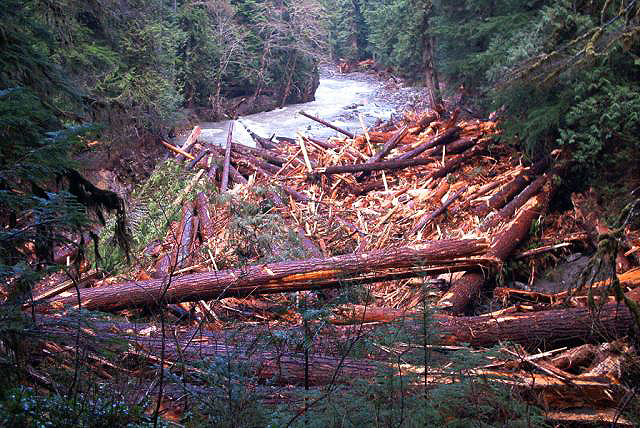 Here is the primary deposition zone for all of the timber that was unearthed in the same landslide.
  The river also moved and in doing so, took a couple of the campsites with it. Here is the new loop C of Ohana.
No comments:
Post a Comment